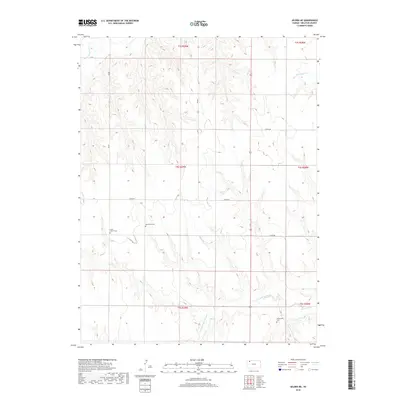
2018 Map of Selden NE
USGS Topo · Published 2018About this map
Decatur County's high plains landscape is defined by the winding drainages of the N Fork Prairie Dog Cr and Prairie Dog Cr in the southern reaches, while the S Fork Sappa Cr clips the northwestern corner. This area of Kansas is marked by a legacy of rural religious community, evidenced by the clustered locations of the Lund Church Cem, Mennonite Cem, and Shibboleth Cem. The map illustrates a strictly organized grid of sectional roads, including 700 Rd and Co Rd 352, which serve the agricultural parcels that have long sustained this region. Small tributaries like Big Timber Cr carve subtle relief into the terrain, showing the essential relationship between water sources and settlement patterns in the state's northwestern interior.
Find a feature on this map
22 named features on this map. Tap any name to fly to it.
Don’t see what you’re looking for? This feature index may not catch every label — zoom into the map to look around manually.
Map Details
Editions of this 2018 Selden NE Map
This is the sole edition of this map. No revisions or reprints were ever made.
Other maps of this area

1951 · Selden
USGS Topo · 1:62,500

1951 · Oberlin
USGS Topo · 1:62,500

1951 · Kanona
USGS Topo · 1:62,500

1954 · Goodland
USGS Topo · 1:250,000

1956 · Goodland
USGS Topo · 1:250,000

1957 · Goodland
USGS Topo · 1:250,000

1965 · Oberlin
USGS Topo · 1:24,000

1965 · Kanona
USGS Topo · 1:24,000

1965 · Oberlin SW
USGS Topo · 1:24,000

1965 · Selden NW
USGS Topo · 1:24,000