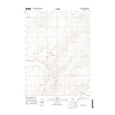
2014 Map of Seldovia D-5 SE
USGS Topo · Published 2014About this map
Klutchevya and Nahotka anchor the interior of this Kenai Peninsula landscape, where a dense network of local roads reveals a pattern of modern homesteading and rural expansion. The area is defined by the drainage of the N Fork Anchor River and the Chakok River, with high points like Epperson Knob rising above the plateaus. Notable family-named and descriptive thoroughfares such as Nikolaevsk Road, Tall Tree Avenue, and Wagon Road lattice the terrain, indicating a community built around traditional access routes. To the south, the terrain descends toward Diamond Ridge, marking the transition toward the coastal bluffs. This 2014 survey captures a specific stage of development in a region where the intersection of natural watercourses and winding mountain roads dictates the layout of remote Alaskan settlements.
Find a feature on this map
32 named features on this map. Tap any name to fly to it.
Don’t see what you’re looking for? This feature index may not catch every label — zoom into the map to look around manually.
Map Details
Editions of this 2014 Seldovia D-5 SE Map
This is the sole edition of this map. No revisions or reprints were ever made.
Other maps of this area

1946 · Seldovia C-5
USGS Topo · 1:63,360

1946 · Seldovia D-5
USGS Topo · 1:63,360

1948 · Seldovia C-4
USGS Topo · 1:63,360

1949 · Seldovia C-4
USGS Topo · 1:62,500

1949 · Seldovia D-4
USGS Topo · 1:63,360

1951 · Seldovia C-5
USGS Topo · 1:63,360

1951 · Seldovia D-5
USGS Topo · 1:63,360

1951 · Seldovia D-4
USGS Topo · 1:63,360

1951 · Seldovia
USGS Topo · 1:250,000

1961 · Seldovia C-5
USGS Topo · 1:63,360