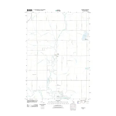
2011 Map of Selkirk
USGS Topo · Published 2011About this map
The Rifle River flows southward through Ogemaw County, anchoring a landscape where rural township life meets mid-century recreation. At the center of the sheet, the small settlement of Selkirk stands near the Churchill Township Cemetery, while the Thompson Airport provides a clear landmark for the local aviation history of the region. The southern portion of the map is dominated by the development around Lake Ogemaw, including the Ogemaw County Fairgrounds and Troll Landing Campground, indicating the area's transition into a hub for community gatherings and seasonal visitors. In the northeast, Henderson Lake and Camp Lu Lay Lea further illustrate the tradition of lakeside camps and retreats. This 2011 survey reveals a grid of county roads, such as State Rd and Sage Lake Rd, that connect scattered homesteads with numerous waterways like Ammond Creek and Dedrich Creek.
Find a feature on this map
63 named features on this map. Tap any name to fly to it.
Don’t see what you’re looking for? This feature index may not catch every label — zoom into the map to look around manually.
Map Details
Editions of this 2011 Selkirk Map
This is the sole edition of this map. No revisions or reprints were ever made.
Other maps of this area

1954 · Traverse City
USGS Topo · 1:250,000

1954 · Tawas City
USGS Topo · 1:250,000

1958 · Traverse City
USGS Topo · 1:250,000

1958 · Tawas City
USGS Topo · 1:250,000

1965 · Damon
USGS Topo · 1:24,000

1965 · West Branch
USGS Topo · 1:24,000

1965 · Selkirk
USGS Topo · 1:24,000

1965 · Rose City
USGS Topo · 1:24,000

1968 · Prescott
USGS Topo · 1:24,000

1968 · Sage Lake
USGS Topo · 1:24,000