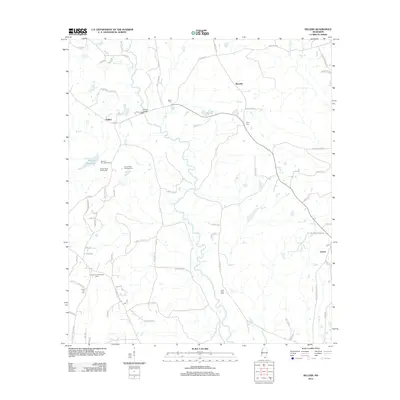
2012 Map of Sellers
USGS Topo · Published 2012About this map
Wolf River and Sandy Cr wind through this Harrison County landscape, defining a rural corridor marked by several family-named cemeteries and small crossroads settlements. Local history is anchored at Riceville and Sellers, where Sellers Bridge crosses the main waterway along Hwy 53. The map reveals a land use pattern dominated by recreation and forestry, featuring the Salmen Scout Reservation, Salmon Boy Scout Camp, and Country Acres Summer Camp. Genealogists may find value in the scattered burial grounds, including Shaw Cem, Page Cem, and Wolf River Cem, which sit alongside historic routes such as McHenry Rd and Saucier Advance Rd. The drainage network, including Crane Cr and Little Biloxi River, illustrates the hydrologic character of this piney woods region.
Find a feature on this map
76 named features on this map. Tap any name to fly to it.
Don’t see what you’re looking for? This feature index may not catch every label — zoom into the map to look around manually.
Map Details
Editions of this 2012 Sellers Map
This is the sole edition of this map. No revisions or reprints were ever made.
Other maps of this area

1953 · Mobile
USGS Topo · 1:250,000

1954 · McHenry
USGS Topo · 1:62,500

1955 · Savannah
USGS Topo · 1:62,500

1956 · Vidalia
USGS Topo · 1:24,000

1956 · Gulfport NW
USGS Topo · 1:24,000

1957 · Mobile
USGS Topo · 1:250,000
1959 · Kiln
USGS Topo · 1:24,000

1960 · Mobile
USGS Topo · 1:250,000

1963 · Mobile
USGS Topo · 1:250,000

1965 · Mobile
USGS Topo · 1:250,000