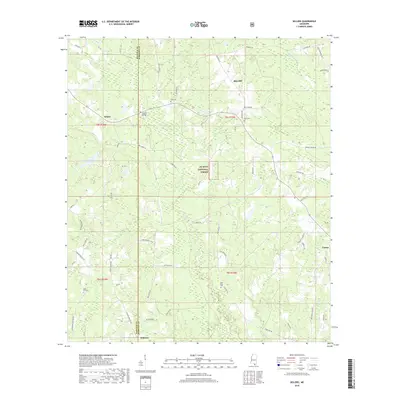
2018 Map of Sellers
USGS Topo · Published 2018About this map
Riceville and Sellers occupy a landscape shaped by the Wolf River and its numerous tributaries as they flow south through the Mississippi pine forests. This 2018 survey documents a region defined by scattered rural settlements and timberland management within the De Soto National Forest. The geography here is notably intersectional, as the Hancock Co and Harrison Co line bisects the area near Sellers Bridge and Dedeaux.
Find a feature on this map
68 named features on this map. Tap any name to fly to it.
Don’t see what you’re looking for? This feature index may not catch every label — zoom into the map to look around manually.
Map Details
Editions of this 2018 Sellers Map
This is the sole edition of this map. No revisions or reprints were ever made.
Other maps of this area

1953 · Mobile
USGS Topo · 1:250,000

1954 · McHenry
USGS Topo · 1:62,500

1955 · Savannah
USGS Topo · 1:62,500

1956 · Vidalia
USGS Topo · 1:24,000

1956 · Gulfport NW
USGS Topo · 1:24,000

1957 · Mobile
USGS Topo · 1:250,000
1959 · Kiln
USGS Topo · 1:24,000

1960 · Mobile
USGS Topo · 1:250,000

1963 · Mobile
USGS Topo · 1:250,000

1965 · Mobile
USGS Topo · 1:250,000