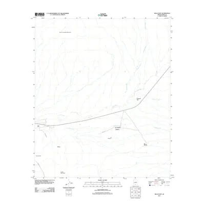
2011 Map of Sells East
USGS Topo · Published 2011About this map
Sells and several nearby indigenous settlements are positioned along a series of critical ephemeral watercourses in this high-desert region of Pima County. The landscape is defined by the broad drainage patterns of Comobabi Wash and Sells Wash, which flow between the South Comobabi Mountains to the north and the Artesa Mountains to the south. Small, concentrated communities such as Chiawuli Tak, Ali Chukson, and Ali Molina are connected by a network of local roads including Artesia Rd and Fed Route 15. The settlement of Suwuk Tontk lies at the southern edge of the map, illustrating the scattered but intentional placement of dwellings near mountain runoff points. This 2011 survey illustrates the modern road infrastructure, such as Main Rd, as it integrates with traditional land use patterns and topographical features.
Find a feature on this map
18 named features on this map. Tap any name to fly to it.
Don’t see what you’re looking for? This feature index may not catch every label — zoom into the map to look around manually.
Map Details
Editions of this 2011 Sells East Map
This is the sole edition of this map. No revisions or reprints were ever made.
Other maps of this area

1934 · Silver Bell
USGS Topo · 1:125,000

1937 · Comobabi
USGS Topo · 1:48,000

1938 · San Vicente
USGS Topo · 1:62,500

1941 · San Vicente
USGS Topo · 1:62,500

1941 · Baboquivari Peak
USGS Topo · 1:62,500

1941 · Sells
USGS Topo · 1:62,500

1942 · San Vicente
USGS Topo · 1:62,500

1942 · Comobabi
USGS Topo · 1:62,500

1943 · Sells
USGS Topo · 1:62,500

1943 · Fresnal
USGS Topo · 1:125,000