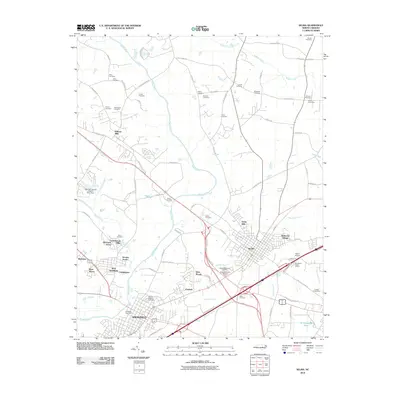
2010 Map of Selma
USGS Topo · Published 2010About this map
The Neuse River and its various tributaries, including Buffalo Creek and Moccasin Creek, carve through this Johnston County landscape as it appeared in the early 21st century. The map centered on Selma and Smithfield reveals a dense network of family cemeteries that speak to the deep genealogical roots of the region, such as Price Cemetery, Vinson Cemetery, and the Crocker Cemeteries. This era shows a transition from traditional agricultural patterns to suburban developments like Redwood Village, Fairfield, and Castlehaven. Modern infrastructure and specialized landmarks are also evident, ranging from Prison Unit 4043 and the Selma Airport to the Southland Estate Winery. The industrial growth of the corridor is reflected in features like Industrial Park Dr and the proximity of these towns to major transportation arteries.
Find a feature on this map
88 named features on this map. Tap any name to fly to it.
Don’t see what you’re looking for? This feature index may not catch every label — zoom into the map to look around manually.
Map Details
Editions of this 2010 Selma Map
This is the sole edition of this map. No revisions or reprints were ever made.
Other maps of this area

1902 · Kenly
USGS Topo · 1:62,500

1903 · Kenly
USGS Topo · 1:62,500

1906 · Four Oaks
USGS Topo · 1:48,000

1908 · Four Oaks
USGS Topo · 1:62,500

1953 · Raleigh
USGS Topo · 1:250,000

1954 · Raleigh
USGS Topo · 1:250,000

1964 · Flowers
USGS Topo · 1:24,000

1964 · Selma
USGS Topo · 1:62,500

1964 · Clayton
USGS Topo · 1:24,000

1964 · Powhatan
USGS Topo · 1:24,000