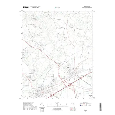
2019 Map of Selma
USGS Topo · Published 2019About this map
The Neuse River winds through this central Johnston County landscape, providing a geographic anchor for the growing rail and road corridor between Smithfield and Selma. This 2019 survey captures the modern expansion of West Smithfield and Oakland Heights alongside traditional agricultural landmarks. The map is particularly rich in genealogical data, preserving the locations of numerous family burial grounds such as Price Cem, Vinson Cem, and the Crocker Cemeteries. To the east, the settlement of Pine Level sits near W I Rowland Pond, while Wilsons Mills occupies the northwestern corner. The density of named cemeteries and small communities like Stancils Chapel reflects a long-established rural network that has increasingly integrated into a more suburban footprint while maintaining its distinct local identifiers.
Find a feature on this map
205 named features on this map. Tap any name to fly to it.
Don’t see what you’re looking for? This feature index may not catch every label — zoom into the map to look around manually.
Map Details
Editions of this 2019 Selma Map
This is the sole edition of this map. No revisions or reprints were ever made.
Other maps of this area

1902 · Kenly
USGS Topo · 1:62,500

1903 · Kenly
USGS Topo · 1:62,500

1906 · Four Oaks
USGS Topo · 1:48,000

1908 · Four Oaks
USGS Topo · 1:62,500

1953 · Raleigh
USGS Topo · 1:250,000

1954 · Raleigh
USGS Topo · 1:250,000

1964 · Flowers
USGS Topo · 1:24,000

1964 · Selma
USGS Topo · 1:62,500

1964 · Clayton
USGS Topo · 1:24,000

1964 · Powhatan
USGS Topo · 1:24,000