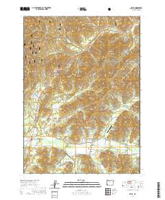
2020 Map of Selma
USGS Topo · Published 2020About this map
Siskiyou National Forest land dominates the northwestern highlands of this Josephine County region, where the terrain transitions from the steep slopes of Wonder Mtn and Hayes Hill into the lower basins of Draper Valley. The settlement of Selma serves as a local hub near the confluence of Anderson Cr and Deer Cr, while the smaller community of Wonder sits to the northeast. A significant water feature, Lake Selmac, is situated south of Selma, created by a damming system near McMullin Cr.
Find a feature on this map
75 named features on this map. Tap any name to fly to it.
Don’t see what you’re looking for? This feature index may not catch every label — zoom into the map to look around manually.
Map Details
Editions of this 2020 Selma Map
This is the sole edition of this map. No revisions or reprints were ever made.
Other maps of this area

1908 · Grants Pass
USGS Topo · 1:125,000

1917 · Kerby
USGS Topo · 1:125,000

1918 · Kerby
USGS Topo · 1:125,000

1945 · Kerby
USGS Topo · 1:125,000

1954 · Cave Junction
USGS Topo · 1:62,500

1954 · Oregon Caves
USGS Topo · 1:62,500

1954 · Selma
USGS Topo · 1:62,500

1954 · Grants Pass
USGS Topo · 1:62,500

1955 · Medford
USGS Topo · 1:250,000

1957 · Medford
USGS Topo · 1:250,000