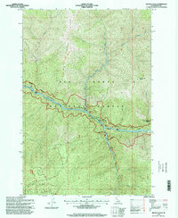
1995 Map of Selway Falls
USGS Topo · Published 1999About this map
The confluence of the Middle Fork Selway River and Meadow Creek serves as the focal point of this mid-1990s forest survey. Within the protected boundaries of the Nez Perce National Forest, the landscape is defined by the convergence of steep canyon walls and powerful water features, most notably the namesake Selway Falls. A network of backcountry access is documented here, including the Glover Roundtop National Recreation Trail tracing the high ground of Glover Ridge and the Meadow Creek National Recreation Trail following the water's edge.
Find a feature on this map
22 named features on this map. Tap any name to fly to it.
Don’t see what you’re looking for? This feature index may not catch every label — zoom into the map to look around manually.
Map Details
Editions of this 1995 Selway Falls Map
This is the sole edition of this map. No revisions or reprints were ever made.
Other maps of this area

1911 · Lolo
USGS Topo · 1:250,000

1913 · Lolo
USGS Topo · 1:250,000

1956 · Elk City
USGS Topo · 1:250,000

1956 · Hamilton
USGS Topo · 1:250,000

1959 · Hamilton
USGS Topo · 1:250,000

1960 · Elk City
USGS Topo · 1:250,000

1960 · Hamilton
USGS Topo · 1:250,000

1964 · Hamilton
USGS Topo · 1:250,000

1966 · Selway Falls
USGS Topo · 1:24,000

1966 · Lick Point
USGS Topo · 1:24,000