
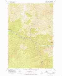
1966 Map of Selway Falls
USGS Topo · Published 1968About this map
The Selway River cuts a deep corridor through the Nez Perce National Forest in this mid-1960s survey, revealing a landscape defined by forest management and backcountry access. At the center of the sheet, the Selway Falls Guard Station sits near a notable Fish Ladder and Tramway, infra-structure critical for navigating the river’s drop. The map documents an era of burgeoning forest recreation, shown by a string of riverside sites including Glover Campground, Selway Falls Campground, and Slims Campground. Higher elevations like Glover Ridge and Fog Mountain Saddle are connected only by a Pack Trail, emphasizing the primitive character of the Selway-Bitterroot Wilderness boundary. Tributaries such as Meadow Creek and Gedney Creek drain the steep slopes, while river bars like Twentyfive Mile Bar provide rare flat ground in this vertical terrain.
Find a feature on this map
27 named features on this map. Tap any name to fly to it.
Don’t see what you’re looking for? This feature index may not catch every label — zoom into the map to look around manually.
Map Details
Editions of this 1966 Selway Falls Map
3 editions found
Other maps of this area

1911 · Lolo
USGS Topo · 1:250,000

1913 · Lolo
USGS Topo · 1:250,000

1956 · Elk City
USGS Topo · 1:250,000

1956 · Hamilton
USGS Topo · 1:250,000

1959 · Hamilton
USGS Topo · 1:250,000

1960 · Elk City
USGS Topo · 1:250,000

1960 · Hamilton
USGS Topo · 1:250,000

1964 · Hamilton
USGS Topo · 1:250,000

1966 · Lick Point
USGS Topo · 1:24,000

1966 · Anderson Butte
USGS Topo · 1:24,000