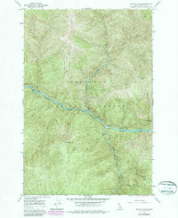
1966 Map of Selway Falls
USGS Topo · Published 1987About this map
The confluence of the Selway River and Meadow Creek defines this reach of the Nezperce National Forest during the mid-1960s. The landscape is oriented around the powerful hydrology of the river system, featuring the namesake Selway Falls and specialized infrastructure such as a Fish Ladder and Gaging Station near the river bend. The map illustrates a shift toward wilderness preservation and recreation, with the Selway-Bitterroot Wilderness boundary cutting across the eastern slopes. A network of primitive facilities, including Gedney Creek and Race Creek Campground, serves those navigating the river corridor. Human movement through the steep terrain is restricted to the river-bank roads and a high-elevation Pack Trail that crosses Glover Ridge, highlighting the area's role as a managed natural sanctuary for the Forest Service and recreational visitors.
Find a feature on this map
31 named features on this map. Tap any name to fly to it.
Don’t see what you’re looking for? This feature index may not catch every label — zoom into the map to look around manually.
Map Details
Editions of this 1966 Selway Falls Map
3 editions found
Other maps of this area

1911 · Lolo
USGS Topo · 1:250,000

1913 · Lolo
USGS Topo · 1:250,000

1956 · Elk City
USGS Topo · 1:250,000

1956 · Hamilton
USGS Topo · 1:250,000

1959 · Hamilton
USGS Topo · 1:250,000

1960 · Elk City
USGS Topo · 1:250,000

1960 · Hamilton
USGS Topo · 1:250,000

1964 · Hamilton
USGS Topo · 1:250,000

1966 · Selway Falls
USGS Topo · 1:24,000

1966 · Lick Point
USGS Topo · 1:24,000