
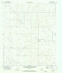
1970 Map of Seminole NE
USGS Topo · Published 1973About this map
Industrial development in Gaines County is dominated by the extensive Seminole East Oil Field and the Wescott Oil Field, illustrating the intensive petroleum extraction character of the West Texas landscape by 1970. The presence of a refinery and numerous well sites across the plains underscores the mid-century energy boom that transformed this region. Despite the industrial footprint, traditional land uses are visible at the Rodeo Ground near the western edge of the map.
Find a feature on this map
12 named features on this map. Tap any name to fly to it.
Don’t see what you’re looking for? This feature index may not catch every label — zoom into the map to look around manually.
Map Details
Editions of this 1970 Seminole NE Map
This is the sole edition of this map. No revisions or reprints were ever made.
Other maps of this area

1954 · Hobbs
USGS Topo · 1:250,000

1958 · Hobbs
USGS Topo · 1:250,000

1969 · Seminole SW
USGS Topo · 1:24,000

1970 · Seagraves SW
USGS Topo · 1:24,000

1970 · Cedar Point Ranch
USGS Topo · 1:24,000

1970 · Seagraves SE
USGS Topo · 1:24,000

1970 · McKenzie Lake NW
USGS Topo · 1:24,000

1970 · Seminole SE
USGS Topo · 1:24,000
1970 · Loop SW
USGS Topo · 1:24,000

1970 · Seminole
USGS Topo · 1:24,000