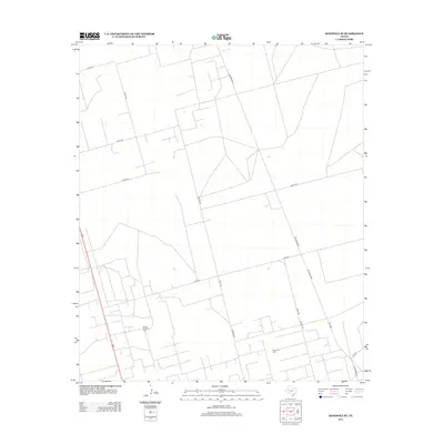
2012 Map of Seminole SE
USGS Topo · Published 2012About this map
The Means North Oil Field and Nolley Oil Field define the industrial character of this corner of Gaines County during the early 21st century. The landscape is marked by a precise, geometric grid of county roads and service routes necessary for energy extraction, with Telephone Rd and FM 1788 serving as primary north-south arteries. The lack of traditional town centers or residential settlements emphasizes the area's role as a dedicated production zone. Local naming conventions are evident in smaller routes such as Molley Rd and Norman Rd, which interlace with numbered paths like Co Rd 420 and Co Rd 422. This map provides a detailed look at the logistical infrastructure of the Texas oil patch before newer developments shifted the regional footprint.
Find a feature on this map
16 named features on this map. Tap any name to fly to it.
Don’t see what you’re looking for? This feature index may not catch every label — zoom into the map to look around manually.
Map Details
Editions of this 2012 Seminole SE Map
This is the sole edition of this map. No revisions or reprints were ever made.
Other maps of this area

1954 · Hobbs
USGS Topo · 1:250,000

1958 · Hobbs
USGS Topo · 1:250,000

1969 · Seminole SW
USGS Topo · 1:24,000

1970 · Seminole NE
USGS Topo · 1:24,000

1970 · Cedar Point Ranch
USGS Topo · 1:24,000

1970 · McKenzie Lake NW
USGS Topo · 1:24,000

1970 · Seminole SE
USGS Topo · 1:24,000

1970 · Seminole
USGS Topo · 1:24,000

1971 · Five Wells Ranch NW
USGS Topo · 1:24,000

1971 · Florey
USGS Topo · 1:24,000