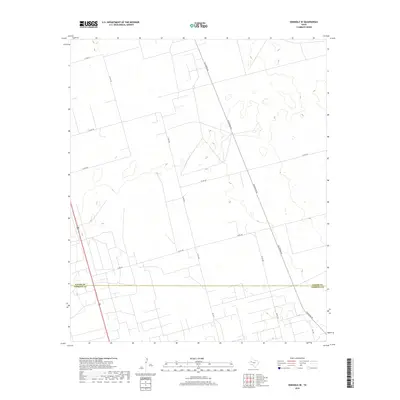
2019 Map of Seminole SE
USGS Topo · Published 2019About this map
The boundary between Gaines Co and Andrews Co bisects this West Texas landscape, a region defined by a systematic grid of county roads and industrial corridors. In the late 2010s, this area south of Seminole serves as a critical junction for transportation and resource management, anchored by the north-south artery of Highway 385. The terrain is characterized by subtle elevation shifts and scattered depressions, interwoven with a dense network of local routes such as Telephone Rd and Nolley Rd. These thoroughfares, along with numbered ways like Co Rd 422 and Co Rd 426, reveal the organizational footprint of the Permian Basin's high plains, where the land is partitioned for agricultural and energy interests. The survey provides a clear view of the rural infrastructure connecting disparate homesteads and industrial sites across the county line.
Find a feature on this map
14 named features on this map. Tap any name to fly to it.
Don’t see what you’re looking for? This feature index may not catch every label — zoom into the map to look around manually.
Map Details
Editions of this 2019 Seminole SE Map
This is the sole edition of this map. No revisions or reprints were ever made.
Other maps of this area

1954 · Hobbs
USGS Topo · 1:250,000

1958 · Hobbs
USGS Topo · 1:250,000

1969 · Seminole SW
USGS Topo · 1:24,000

1970 · Seminole NE
USGS Topo · 1:24,000

1970 · Cedar Point Ranch
USGS Topo · 1:24,000

1970 · McKenzie Lake NW
USGS Topo · 1:24,000

1970 · Seminole SE
USGS Topo · 1:24,000

1970 · Seminole
USGS Topo · 1:24,000

1971 · Five Wells Ranch NW
USGS Topo · 1:24,000

1971 · Florey
USGS Topo · 1:24,000