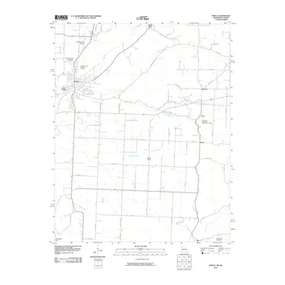
2010 Map of Seneca
USGS Topo · Published 2010About this map
Seneca sits at the western edge of Newton County along the Missouri-Oklahoma border, serving as a focal point for this 2010 topographic study. The landscape transitions from the Springfield Plain toward the broken terrain of Charleton Hollow, defined by the drainage of Lost Creek and Little Lost Creek. This era of the landscape is marked by modern water management infrastructure, including the Newton County Structure F-1 Dam and several companion structures designed to control runoff across the watershed. Rural life and legacy are anchored by sites such as Swars Prairie and the Wilson Cemetery, while smaller outlying settlements like Westview, Dessa, and May dot the interior. The map also records the developed pocket of Wela Park and the distinct community of West Seneca just across the state line, providing a precise record of local connectivity and rural property divisions at the turn of the decade.
Find a feature on this map
62 named features on this map. Tap any name to fly to it.
Don’t see what you’re looking for? This feature index may not catch every label — zoom into the map to look around manually.
Map Details
Editions of this 2010 Seneca Map
This is the sole edition of this map. No revisions or reprints were ever made.
Other maps of this area

1907 · Wyandotte
USGS Topo · 1:125,000

1909 · Wyandotte
USGS Topo · 1:125,000

1916 · Neosho
USGS Topo · 1:62,500

1940 · Noel
USGS Topo · 1:62,500

1943 · Noel
USGS Topo · 1:62,500

1949 · Seneca
USGS Topo · 1:24,000

1949 · Racine
USGS Topo · 1:24,000

1950 · Seneca
USGS Topo · 1:24,000

1950 · Racine
USGS Topo · 1:24,000

1954 · Tulsa
USGS Topo · 1:250,000