
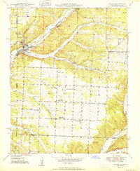
1950 Map of Seneca
USGS Topo · Published 1950About this map
Seneca sits at the intersection of industry and agriculture during the mid-century, where the St Louis San Francisco railroad cuts through the valley floor. The map highlights a landscape defined by its mineral resources and rural community hubs, featuring a Strip Mine near the town center and specialized Tripoli Mine operations to the northeast. These extraction sites operated alongside a dense network of country schools like Gallemore Sch and Hickory Grove Sch, and spiritual centers such as Hollow Springs Ch.
Find a feature on this map
32 named features on this map. Tap any name to fly to it.
Don’t see what you’re looking for? This feature index may not catch every label — zoom into the map to look around manually.
Map Details
Editions of this 1950 Seneca Map
2 editions found
Other maps of this area

1907 · Wyandotte
USGS Topo · 1:125,000

1909 · Wyandotte
USGS Topo · 1:125,000

1916 · Neosho
USGS Topo · 1:62,500

1940 · Noel
USGS Topo · 1:62,500

1943 · Noel
USGS Topo · 1:62,500

1949 · Seneca
USGS Topo · 1:24,000

1949 · Racine
USGS Topo · 1:24,000

1950 · Racine
USGS Topo · 1:24,000

1954 · Tulsa
USGS Topo · 1:250,000

1958 · Tulsa
USGS Topo · 1:250,000