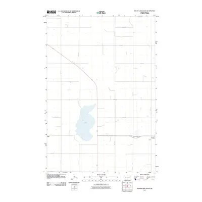
2011 Map of Senger Lake South
USGS Topo · Published 2011About this map
Hague and the nearby community of Hull anchor this section of the Great Plains, where the landscape is organized by a precise grid of section roads. The map highlights the agricultural geometry of Emmons County, defined by routes such as 96th St SE and 14th Ave SE. A significant geographic feature is Rice Lake, which dominates the central portion of the quadrangle and likely served as a local landmark for generations of residents in this prairie setting. For those researching family history in the area, Saint Marys Cemetery is clearly marked just west of Hague, providing a vital touchpoint for genealogical study. The layout of these small settlements alongside the expanse of the lake reflects the typical late-20th and early-21st-century rural development patterns of North Dakota.
Find a feature on this map
18 named features on this map. Tap any name to fly to it.
Don’t see what you’re looking for? This feature index may not catch every label — zoom into the map to look around manually.
Map Details
Editions of this 2011 Senger Lake South Map
This is the sole edition of this map. No revisions or reprints were ever made.
Other maps of this area

1953 · Jamestown
USGS Topo · 1:250,000

1953 · McIntosh
USGS Topo · 1:250,000

1954 · Aberdeen
USGS Topo · 1:250,000

1954 · Bismarck
USGS Topo · 1:250,000

1956 · Aberdeen
USGS Topo · 1:250,000

1956 · Jamestown
USGS Topo · 1:250,000

1958 · Bismarck
USGS Topo · 1:250,000

1958 · McIntosh
USGS Topo · 1:250,000

1965 · Herreid NW
USGS Topo · 1:24,000

1965 · Herreid NE
USGS Topo · 1:24,000