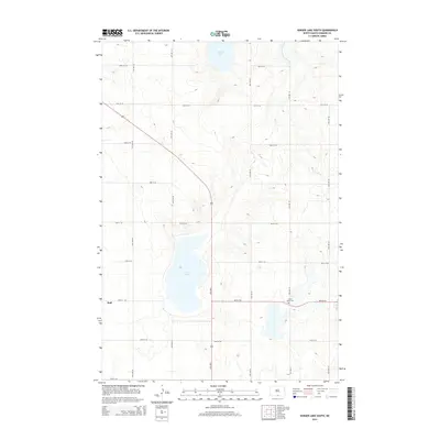
2014 Map of Senger Lake South
USGS Topo · Published 2014About this map
Rice Lake and Senger Lake dominate the northern and central stretches of this agricultural landscape in Emmons County. The terrain is defined by a grid of rural sections, with the settlement of Hull positioned along the western edge. This map documents a quiet, prairie-centered corner of North Dakota where the road network follows strict township lines, intersected only by the diagonal path of Highway 83. The presence of Saint Marys Cem near the intersection of 96th St SE and 17th Ave SE serves as a primary landmark for local genealogy, marking a historical site of community gathering in an area characterized by dispersed farmsteads and glacial lake basins.
Find a feature on this map
19 named features on this map. Tap any name to fly to it.
Don’t see what you’re looking for? This feature index may not catch every label — zoom into the map to look around manually.
Map Details
Editions of this 2014 Senger Lake South Map
This is the sole edition of this map. No revisions or reprints were ever made.
Other maps of this area

1953 · Jamestown
USGS Topo · 1:250,000

1953 · McIntosh
USGS Topo · 1:250,000

1954 · Aberdeen
USGS Topo · 1:250,000

1954 · Bismarck
USGS Topo · 1:250,000

1956 · Aberdeen
USGS Topo · 1:250,000

1956 · Jamestown
USGS Topo · 1:250,000

1958 · Bismarck
USGS Topo · 1:250,000

1958 · McIntosh
USGS Topo · 1:250,000

1965 · Herreid NW
USGS Topo · 1:24,000

1965 · Herreid NE
USGS Topo · 1:24,000