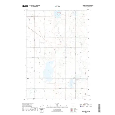
2017 Map of Senger Lake South
USGS Topo · Published 2017About this map
Rice Lake dominates the center of this southern Emmons County landscape, providing a significant hydrological anchor for the surrounding agricultural prairie. To the southeast, the small settlement of Hague is situated near the Old Saint John's Catholic Cem, a site of vital importance for genealogists and local historians documenting the early community. The landscape is structured by a rigid section-line road grid, including 15th Ave SE and 96th St SE, which connect the town to the outlying settlement of Hull in the west. This 2017 survey reflects the enduring rural character of North Dakota's border region, where large water bodies like Senger Lake and marshy depressions interrupt the systematic township divisions of t130n r75w and t129n r75w.
Find a feature on this map
25 named features on this map. Tap any name to fly to it.
Don’t see what you’re looking for? This feature index may not catch every label — zoom into the map to look around manually.
Map Details
Editions of this 2017 Senger Lake South Map
This is the sole edition of this map. No revisions or reprints were ever made.
Other maps of this area

1953 · Jamestown
USGS Topo · 1:250,000

1953 · McIntosh
USGS Topo · 1:250,000

1954 · Aberdeen
USGS Topo · 1:250,000

1954 · Bismarck
USGS Topo · 1:250,000

1956 · Aberdeen
USGS Topo · 1:250,000

1956 · Jamestown
USGS Topo · 1:250,000

1958 · Bismarck
USGS Topo · 1:250,000

1958 · McIntosh
USGS Topo · 1:250,000

1965 · Herreid NW
USGS Topo · 1:24,000

1965 · Herreid NE
USGS Topo · 1:24,000