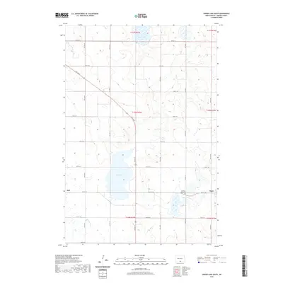
2020 Map of Senger Lake South
USGS Topo · Published 2020About this map
Rice Lake and Senger Lake anchor this agricultural landscape in Emmons County, where the topography is defined by the gentle drainage patterns and glacial depressions characteristic of the Missouri Coteau region. The rural settlement of Hague is situated in the southeastern portion of the map, serving as a local focal point alongside the smaller community of Hull to the west. A significant landmark for genealogists and local historians is the Old Saint Marys Cem, located near the intersection of 96th St SE and the primary north-south corridor of 10th Ave SE. The grid-like arrangement of section lines and gravel roads, including 90th St SE and 98th St SE, illustrates the enduring influence of the Public Land Survey System on North Dakota’s prairie development.
Find a feature on this map
21 named features on this map. Tap any name to fly to it.
Don’t see what you’re looking for? This feature index may not catch every label — zoom into the map to look around manually.
Map Details
Editions of this 2020 Senger Lake South Map
This is the sole edition of this map. No revisions or reprints were ever made.
Other maps of this area

1953 · Jamestown
USGS Topo · 1:250,000

1953 · McIntosh
USGS Topo · 1:250,000

1954 · Aberdeen
USGS Topo · 1:250,000

1954 · Bismarck
USGS Topo · 1:250,000

1956 · Aberdeen
USGS Topo · 1:250,000

1956 · Jamestown
USGS Topo · 1:250,000

1958 · Bismarck
USGS Topo · 1:250,000

1958 · McIntosh
USGS Topo · 1:250,000

1965 · Herreid NW
USGS Topo · 1:24,000

1965 · Herreid NE
USGS Topo · 1:24,000