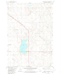
1979 Map of Senger Lake South
USGS Topo · Published 1980About this map
The agrarian landscape of Emmons County is defined by the diagonal transit of the Chicago Milwaukee St Paul and Pacific railroad through the hills of Harding. In the late 1970s, this corridor remained a vital link for the small prairie settlements of Hull and Hague, the latter of which sits at the junction of State Highway 11 and the rail line. The presence of a Weigh Station near the tracks suggests the continued importance of the grain and livestock economy to these rural communities.
Find a feature on this map
17 named features on this map. Tap any name to fly to it.
Don’t see what you’re looking for? This feature index may not catch every label — zoom into the map to look around manually.
Map Details
Editions of this 1979 Senger Lake South Map
This is the sole edition of this map. No revisions or reprints were ever made.
Other maps of this area

1953 · Jamestown
USGS Topo · 1:250,000

1953 · McIntosh
USGS Topo · 1:250,000

1954 · Aberdeen
USGS Topo · 1:250,000

1954 · Bismarck
USGS Topo · 1:250,000

1956 · Aberdeen
USGS Topo · 1:250,000

1956 · Jamestown
USGS Topo · 1:250,000

1958 · Bismarck
USGS Topo · 1:250,000

1958 · McIntosh
USGS Topo · 1:250,000

1965 · Herreid NW
USGS Topo · 1:24,000

1965 · Herreid NE
USGS Topo · 1:24,000