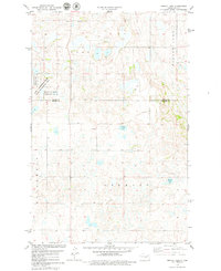
1978 Map of Senior Lake
USGS Topo · Published 1979About this map
Glacial prairie potholes and seasonal wetlands dominate this landscape along the border of Wells and Kidder Counties in the late 1970s. The topography is defined by significant water bodies such as Silver Lake, Senior Lake, and Rush Lake, which serve as critical habitats within the Karl T Frederick State Game Management Area and the National Waterfowl Production Area. These protected zones highlight the region's importance to migratory bird populations and conservation efforts.
Find a feature on this map
12 named features on this map. Tap any name to fly to it.
Don’t see what you’re looking for? This feature index may not catch every label — zoom into the map to look around manually.
Map Details
Editions of this 1978 Senior Lake Map
This is the sole edition of this map. No revisions or reprints were ever made.
Other maps of this area

1952 · New Rockford
USGS Topo · 1:250,000

1954 · McClusky
USGS Topo · 1:250,000

1956 · New Rockford
USGS Topo · 1:250,000

1958 · McClusky
USGS Topo · 1:250,000

1971 · New Rockford
USGS Topo · 1:250,000

1972 · Tuttle
USGS Topo · 1:24,000

1972 · Robinson
USGS Topo · 1:24,000
1978 · Goodrich East
USGS Topo · 1:24,000
1978 · Willow Lake
USGS Topo · 1:24,000
1978 · Hurdsfield
USGS Topo · 1:24,000