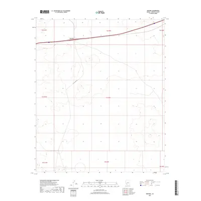
2018 Map of Sentinel
USGS Topo · Published 2018About this map
Sentinel sits as a lonely outpost along the southern transcontinental transportation corridor in this high-desert region of Maricopa County. The landscape is defined by its vast openness and the long, linear trajectories of infrastructure that cross it, including the modern paths that parallel the historic Southern Pacific route. S Agua Caliente Rd strikes out from the settlement, cutting diagonally across the township lines of t7s r10w, t7s r9w, and t6s r10w. The sparse arrangement of labels reflects the arid nature of the terrain, where water and transit have historically dictated the location of every permanent structure. This 2018 study captures the geometric precision of the Public Land Survey System, dividing the desert into the regular blocks of t8s r9w and surrounding ranges that characterize this remote corner of Arizona.
Find a feature on this map
10 named features on this map. Tap any name to fly to it.
Don’t see what you’re looking for? This feature index may not catch every label — zoom into the map to look around manually.
Map Details
Editions of this 2018 Sentinel Map
This is the sole edition of this map. No revisions or reprints were ever made.
Other maps of this area

1927 · Aguila Mountains
USGS Topo · 1:48,000

1929 · Aztec
USGS Topo · 1:62,500

1930 · Aguila Mountains
USGS Topo · 1:62,500

1949 · Sentinel
USGS Topo · 1:62,500

1950 · Sentinel
USGS Topo · 1:62,500

1950 · Aztec
USGS Topo · 1:62,500

1953 · Ajo
USGS Topo · 1:250,000

1957 · Ajo
USGS Topo · 1:250,000

1958 · Ajo
USGS Topo · 1:250,000

1962 · Ajo
USGS Topo · 1:250,000