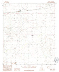
1986 Map of Sentinel
USGS Topo · Published 1986About this map
Sentinel serves as the primary outpost on this desert sheet, situated along the Southern Pacific railroad corridor. The landscape is defined by the sweeping basaltic expanse of the Sentinel Plain and the dark volcanic terrain of the Malpais, which gives way to isolated rises like Huerfano Hill. This area represents a critical military and transit interface in the mid-1980s, dominated by the northern reaches of the Luke Air Force Range.
Find a feature on this map
10 named features on this map. Tap any name to fly to it.
Don’t see what you’re looking for? This feature index may not catch every label — zoom into the map to look around manually.
Map Details
Editions of this 1986 Sentinel Map
This is the sole edition of this map. No revisions or reprints were ever made.
Other maps of this area

1927 · Aguila Mountains
USGS Topo · 1:48,000

1929 · Aztec
USGS Topo · 1:62,500

1930 · Aguila Mountains
USGS Topo · 1:62,500

1949 · Sentinel
USGS Topo · 1:62,500

1950 · Sentinel
USGS Topo · 1:62,500

1950 · Aztec
USGS Topo · 1:62,500

1953 · Ajo
USGS Topo · 1:250,000

1957 · Ajo
USGS Topo · 1:250,000

1958 · Ajo
USGS Topo · 1:250,000

1962 · Ajo
USGS Topo · 1:250,000