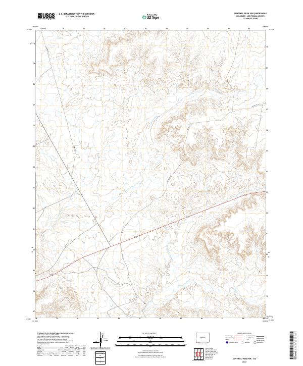
2022 Map of Sentinel Peak SW
USGS Topo · Published 2022About this map
The Mancos River winds through the southern reaches of this landscape in Montezuma County, illustrating a complex network of drainage systems that include Cowboy Wash and Aztec Wash. This 2022 survey documents a region defined by its hydrography and tribal road networks, such as Indian Rte 237 and Indian Rte 232. The map provides a contemporary record of land divisions across township and range lines, including t33n r19w and t32n r20w, which reflect the historical and modern administrative boundaries in this part of southwestern Colorado. The topographical detail reveals the intricate erosion patterns and seasonal watercourses that have shaped the territory's development and access over decades of land management.
Find a feature on this map
9 named features on this map. Tap any name to fly to it.
Don’t see what you’re looking for? This feature index may not catch every label — zoom into the map to look around manually.
Map Details
Editions of this 2022 Sentinel Peak SW Map
This is the sole edition of this map. No revisions or reprints were ever made.
Other maps of this area

1886 · Abajo
USGS Topo · 1:250,000

1889 · Chaco
USGS Topo · 1:250,000

1892 · Abajo
USGS Topo · 1:250,000

1892 · Chaco
USGS Topo · 1:250,000

1892 · Canyon De Chelly
USGS Topo · 1:250,000

1893 · Abajo
USGS Topo · 1:250,000

1934 · Rattlesnake
USGS Topo · 1:62,500

1937 · Rattlesnake
USGS Topo · 1:62,500

1953 · Pastora Peak NE
USGS Topo · 1:24,000

1953 · Pastora Peak
USGS Topo · 1:62,500