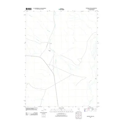
2011 Map of Sentinel Rock
USGS Topo · Published 2011About this map
Smith Ranch and Home Ranch anchor this landscape of the High Desert, representing the enduring presence of ranching in Humboldt County. The geography is defined by a network of drainage systems, most notably the Quinn River which flows along the eastern edge of the quadrangle. Other vital water sources like Crowley Creek, Rock Creek, and Cherry Creek provide the lifeblood for this arid territory, where water rights and access traditionally dictated the placement of early homesteads and current operations. The prominent Sentinel Rock serves as a distinctive natural landmark, standing watch over the intersection of local routes and the northern reaches of Jordan Meadow Rd. This 2011 survey by the U.S. Geological Survey illustrates the intersection of modern transportation with long-established western land use patterns.
Find a feature on this map
9 named features on this map. Tap any name to fly to it.
Don’t see what you’re looking for? This feature index may not catch every label — zoom into the map to look around manually.
Map Details
Editions of this 2011 Sentinel Rock Map
This is the sole edition of this map. No revisions or reprints were ever made.
Other maps of this area

1882 · Paradise
USGS Topo · 1:250,000

1886 · Disaster
USGS Topo · 1:250,000

1893 · Paradise
USGS Topo · 1:250,000

1893 · Disaster
USGS Topo · 1:250,000

1954 · Vya
USGS Topo · 1:250,000

1955 · McDermitt
USGS Topo · 1:250,000

1958 · Vya
USGS Topo · 1:250,000

1959 · McDermitt
USGS Topo · 1:250,000

1959 · Orovada
USGS Topo · 1:62,500

1959 · Jordan Meadow
USGS Topo · 1:62,500