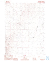
1991 Map of Sentinel Rock
USGS Topo · Published 1991About this map
Sentinel Rock stands as a prominent landmark at the center of this terrain where the high elevations of the Double H Mountains descend into the Quinn River Valley. This remote landscape in Humboldt County is defined by the drainage patterns of Crowley Creek, Pole Creek, and Cherry Creek, which flow toward the north-south corridor of the Quinn River. Evidence of land use is sparse but specific, with a Prospect in the north and a Borrow Pit and Quarry further south, suggesting localized mineral exploration and material extraction. A long Transmission Line cuts across the valley floor, marking the encroachment of infrastructure into the Great Basin. The map identifies critical water sources in this arid environment, including a Spring, Well, and Water Tank, which were essential for both livestock and early surveying efforts.
Find a feature on this map
17 named features on this map. Tap any name to fly to it.
Don’t see what you’re looking for? This feature index may not catch every label — zoom into the map to look around manually.
Map Details
Editions of this 1991 Sentinel Rock Map
This is the sole edition of this map. No revisions or reprints were ever made.
Other maps of this area

1882 · Paradise
USGS Topo · 1:250,000

1886 · Disaster
USGS Topo · 1:250,000

1893 · Paradise
USGS Topo · 1:250,000

1893 · Disaster
USGS Topo · 1:250,000

1954 · Vya
USGS Topo · 1:250,000

1955 · McDermitt
USGS Topo · 1:250,000

1958 · Vya
USGS Topo · 1:250,000

1959 · McDermitt
USGS Topo · 1:250,000

1959 · Orovada
USGS Topo · 1:62,500

1959 · Jordan Meadow
USGS Topo · 1:62,500