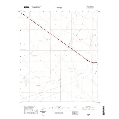
2023 Map of Separ
USGS Topo · Published 2023About this map
Separ sits as a lonely waypoint in the high desert of Grant County, marking a narrow corridor of human activity amidst the arid landscape of southwestern New Mexico. This region is defined by ephemeral watercourses and subtle shifts in elevation, where Ninetysix Creek and the Burro Cienaga drainage weave through the terrain. The presence of Pigeon Hill provides one of the few distinct topographic landmarks in an area dominated by wide, open drainage basins and ranching infrastructure.
Find a feature on this map
12 named features on this map. Tap any name to fly to it.
Don’t see what you’re looking for? This feature index may not catch every label — zoom into the map to look around manually.
Map Details
Editions of this 2023 Separ Map
This is the sole edition of this map. No revisions or reprints were ever made.
Other maps of this area

1954 · Silver City
USGS Topo · 1:250,000

1958 · Silver City
USGS Topo · 1:250,000

1962 · Silver City
USGS Topo · 1:250,000

1962 · Ninetysix Ranch
USGS Topo · 1:24,000

1962 · Lisbon
USGS Topo · 1:24,000

1963 · Soldiers Farewell Hill
USGS Topo · 1:24,000

1964 · Muir Ranch
USGS Topo · 1:24,000
1964 · The Saltys
USGS Topo · 1:24,000
1964 · Separ NE
USGS Topo · 1:24,000
1964 · Separ
USGS Topo · 1:24,000