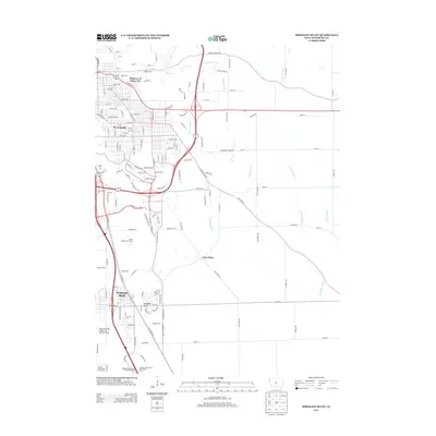
2013 Map of Sergeant Bluff
USGS Topo · Published 2013About this map
Sergeant Bluff anchors the southern portion of this Woodbury County landscape, showing the residential expansion and infrastructure adjacent to the Sioux Gateway Airport/Col. Bud Day Field. The map details the transition from the organized street grids of Morningside and the Regency of Sioux City to the more open, creek-carved terrain to the east. Waterways such as Dead Man Cr and Little Whisky Cr meander through the prairie landscape, framing the small settlement of Glen Ellen.
Find a feature on this map
82 named features on this map. Tap any name to fly to it.
Don’t see what you’re looking for? This feature index may not catch every label — zoom into the map to look around manually.
Map Details
Editions of this 2013 Sergeant Bluff Map
This is the sole edition of this map. No revisions or reprints were ever made.
Other maps of this area

1955 · Sioux City
USGS Topo · 1:250,000

1958 · Sioux City
USGS Topo · 1:250,000

1959 · Sioux City
USGS Topo · 1:250,000

1962 · Union Center
USGS Topo · 1:62,500

1963 · Sioux City South
USGS Topo · 1:24,000

1963 · Sioux City North
USGS Topo · 1:24,000

1964 · Sergeant Bluff
USGS Topo · 1:24,000

1964 · James
USGS Topo · 1:24,000

1964 · Lawton
USGS Topo · 1:24,000

1964 · Luton
USGS Topo · 1:24,000