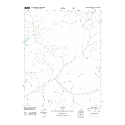
2011 Map of Serviceberry Mountain
USGS Topo · Published 2011About this map
Serviceberry Mountain and the surrounding high-elevation terrain of Archuleta County define this landscape at the edge of the Southern Rockies. The topography is dominated by the deeply incised drainage of the Rito Blanco and the Rio Blanco, which flow through a series of dramatic canyons including Archuleta Canyon, Frio Canyon, and Squaw Canyon. This 2011 survey illustrates the managed water systems of the region, featuring the Echo Canyon Reservoir and its associated Echo Canyon Dam, alongside the hand-cut engineering of the Echo Ditch. While much of the area remains characterized by prominent mesas like Eightmile Mesa, modern land divisions are visible through a network of residential roads such as Saddleback Dr and Loma Linda Dr. Local landmarks like the Blanco River Campground provide specific points of interest for those tracing the development of recreational and natural resources in southwest Colorado.
Find a feature on this map
50 named features on this map. Tap any name to fly to it.
Don’t see what you’re looking for? This feature index may not catch every label — zoom into the map to look around manually.
Map Details
Editions of this 2011 Serviceberry Mountain Map
This is the sole edition of this map. No revisions or reprints were ever made.
Other maps of this area

1913 · Summitville
USGS Topo · 1:125,000

1915 · Summitville
USGS Topo · 1:125,000

1924 · Pagosa Springs
USGS Topo · 1:125,000

1927 · Pagosa Springs
USGS Topo · 1:125,000

1945 · Durango
USGS Topo · 1:250,000

1953 · Durango
USGS Topo · 1:250,000

1954 · Durango
USGS Topo · 1:250,000

1957 · Chromo
USGS Topo · 1:62,500

1957 · Wolf Creek Pass
USGS Topo · 1:62,500

1957 · Pagosa Junction
USGS Topo · 1:62,500