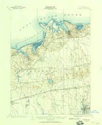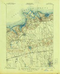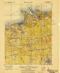
1956 Map of Setauket
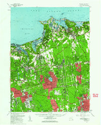
USGS Topo · Published 1961About this map
Central Islip State Hospital and Kings Park State Hospital anchor the interior landscape of mid-century central Suffolk County, reflecting an era when large institutional complexes were major regional landmarks. The North Shore is defined by its irregular coastline, where Port Jefferson Harbor and Stony Brook Harbor create deep natural inlets shielded by landforms like Crane Neck and Old Field Point. Inland, the settlement pattern shows the early stages of suburban expansion around established centers like Smithtown, Stony Brook, and the Village of the Branch. The map also captures significant transportation hubs of the mid-1950s, including MacArthur Airport and the Smithtown Aviation Country Club, alongside the vital Long Island Railroad corridors that connected these growing communities to the broader metropolitan area.
Find a feature on this map
118 named features on this map. Tap any name to fly to it.
Don’t see what you’re looking for? This feature index may not catch every label — zoom into the map to look around manually.
Map Details
Editions of this 1956 Setauket Map
This is the sole edition of this map. No revisions or reprints were ever made.
Historical Maps of Brookhaven Through Time
4 maps found