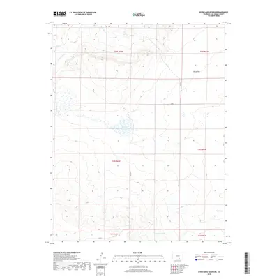
2019 Map of Seven Lakes Reservoir
USGS Topo · Published 2019About this map
Apishapa River and Salado Cr flow through the northwestern corner of this high-desert landscape in Las Animas County. The terrain is characterized by broad, low-lying basins and ephemeral drainage patterns typical of the region, including the seasonal Van Bremer Arroyo which cuts across the southern portion of the quadrangle. Centrally located, the Seven Lakes Reservoir serves as a critical water feature in an otherwise arid expanse.
Find a feature on this map
17 named features on this map. Tap any name to fly to it.
Don’t see what you’re looking for? This feature index may not catch every label — zoom into the map to look around manually.
Map Details
Editions of this 2019 Seven Lakes Reservoir Map
This is the sole edition of this map. No revisions or reprints were ever made.
Other maps of this area

1891 · Apishapa
USGS Topo · 1:125,000

1892 · Elmoro
USGS Topo · 1:125,000

1893 · Apishapa
USGS Topo · 1:125,000

1893 · Elmoro
USGS Topo · 1:125,000

1897 · Elmoro
USGS Topo · 1:125,000

1897 · Apishapa
USGS Topo · 1:125,000

1954 · Trinidad
USGS Topo · 1:250,000

1955 · Trinidad
USGS Topo · 1:250,000

1958 · Trinidad
USGS Topo · 1:250,000

1959 · Trinidad
USGS Topo · 1:250,000