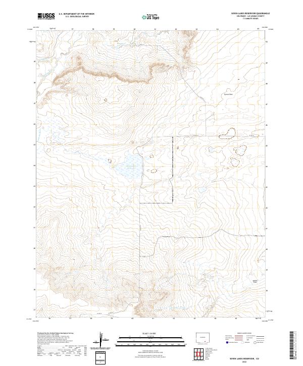
2022 Map of Seven Lakes Reservoir
USGS Topo · Published 2022About this map
Apishapa River flows through the northern reaches of this high plains landscape, cutting through an area defined by wide basins and seasonal watercourses. The central feature, the Seven Lakes Reservoir, serves as a vital hydrological point in a region characterized by prominent lowlands like Tyrone Flats and Adobe Flats. These landforms suggest a traditional ranching or grazing environment, where natural drainage systems like Salado Cr and the Van Bremer Arroyo dictate the movement of livestock and the placement of rural infrastructure. The mapping reveals a sparse but deliberate network of county routes, including Co RD 64 and Co RD 93.9, which connect these remote tracts within Las Animas County. This USGS topographic survey provides a detailed look at the Public Land Survey System grid, illustrating the section lines that historically organized the settlement of the Colorado territory.
Find a feature on this map
17 named features on this map. Tap any name to fly to it.
Don’t see what you’re looking for? This feature index may not catch every label — zoom into the map to look around manually.
Map Details
Editions of this 2022 Seven Lakes Reservoir Map
This is the sole edition of this map. No revisions or reprints were ever made.
Other maps of this area

1891 · Apishapa
USGS Topo · 1:125,000

1892 · Elmoro
USGS Topo · 1:125,000

1893 · Apishapa
USGS Topo · 1:125,000

1893 · Elmoro
USGS Topo · 1:125,000

1897 · Elmoro
USGS Topo · 1:125,000

1897 · Apishapa
USGS Topo · 1:125,000

1954 · Trinidad
USGS Topo · 1:250,000

1955 · Trinidad
USGS Topo · 1:250,000

1958 · Trinidad
USGS Topo · 1:250,000

1959 · Trinidad
USGS Topo · 1:250,000