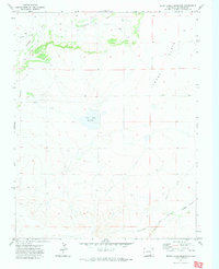
1971 Map of Seven Lakes Reservoir
USGS Topo · Published 1974About this map
The Santa Fe Trail cuts through the southeastern corner of this landscape, marking a historic corridor of western expansion across the high plains of Las Animas County. During this 1971 field check, the terrain is defined by wide expansive benches and seasonal watercourses, including the Apishapa River and Salado Creek which drain the northern sections. The Seven Lakes Reservoir serves as a central hydrological landmark, while the southern reaches transition into the distinct topography of Adobe Flats and the drainage of Van Bremer Arroyo. This area, situated between the Tyrone and Flats regions, preserves a snapshot of a sparsely developed rangeland where isolated landmarks like a Spring or various Well sites and livestock Tank placements provide the only infrastructure for local ranchers and land managers in the early 1970s.
Find a feature on this map
14 named features on this map. Tap any name to fly to it.
Don’t see what you’re looking for? This feature index may not catch every label — zoom into the map to look around manually.
Map Details
Editions of this 1971 Seven Lakes Reservoir Map
This is the sole edition of this map. No revisions or reprints were ever made.
Other maps of this area

1891 · Apishapa
USGS Topo · 1:125,000

1892 · Elmoro
USGS Topo · 1:125,000

1893 · Apishapa
USGS Topo · 1:125,000

1893 · Elmoro
USGS Topo · 1:125,000

1897 · Elmoro
USGS Topo · 1:125,000

1897 · Apishapa
USGS Topo · 1:125,000

1954 · Trinidad
USGS Topo · 1:250,000

1955 · Trinidad
USGS Topo · 1:250,000

1958 · Trinidad
USGS Topo · 1:250,000

1959 · Trinidad
USGS Topo · 1:250,000