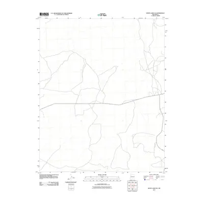
2010 Map of Seven Lakes SE
USGS Topo · Published 2010About this map
Fajada Wash carves through this high desert terrain in the Eastern Navajo Agency, defining the drainage patterns of a landscape marked by its vast, open character. The sparse settlement pattern is reflected in the limited infrastructure, where essential transit is provided by Indian Service Route 7017 and the winding path of Sandspring Rd. These corridors represent the primary connections through this part of the McKinley County plateau, where the arid geography dictates the placement of tracks and service roads. This 2010 edition serves as a precise record of the contemporary road network and hydrographic features within this specific sector of New Mexico.
Find a feature on this map
3 named features on this map. Tap any name to fly to it.
Don’t see what you’re looking for? This feature index may not catch every label — zoom into the map to look around manually.
Map Details
Editions of this 2010 Seven Lakes SE Map
This is the sole edition of this map. No revisions or reprints were ever made.
Other maps of this area

1883 · Mt. Taylor
USGS Topo · 1:250,000

1886 · Mt. Taylor
USGS Topo · 1:250,000

1892 · Mt. Taylor
USGS Topo · 1:250,000

1899 · Mt. Taylor
USGS Topo · 1:250,000

1958 · Albuquerque
USGS Topo · 1:250,000

1961 · Whitehorse
USGS Topo · 1:24,000

1961 · Hospah
USGS Topo · 1:24,000
1961 · Pueblo Pintado
USGS Topo · 1:24,000

1962 · Albuquerque
USGS Topo · 1:250,000
1963 · Laguna Castillo
USGS Topo · 1:24,000