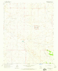
1963 Map of Laguna Castillo
USGS Topo · Published 1965About this map
Chaco Canyon National Monument occupies a significant portion of this high-desert landscape in McKinley County, as recorded during a 1963 field check. The terrain is defined by its sparse water sources and ranching infrastructure, centered around the Laguna Castillo basin. Small-scale human presence is marked by isolated landmarks like the Hardpan Windmill and South Ranch, reflecting the enduring reliance on groundwater in this arid region. The mapping also identifies a Flowing Well to the west, highlighting the critical points of hydration that dictated movement and settlement patterns throughout the mid-20th century. This survey provides a clear view of the land before modern expansion, focusing on the essential topography and designated protected areas of northwestern New Mexico.
Find a feature on this map
5 named features on this map. Tap any name to fly to it.
Don’t see what you’re looking for? This feature index may not catch every label — zoom into the map to look around manually.
Map Details
Editions of this 1963 Laguna Castillo Map
This is the sole edition of this map. No revisions or reprints were ever made.
Other maps of this area

1883 · Mt. Taylor
USGS Topo · 1:250,000

1886 · Wingate
USGS Topo · 1:250,000

1886 · Mt. Taylor
USGS Topo · 1:250,000

1892 · Wingate
USGS Topo · 1:250,000

1892 · Mt. Taylor
USGS Topo · 1:250,000

1899 · Mt. Taylor
USGS Topo · 1:250,000

1954 · Gallup
USGS Topo · 1:250,000

1958 · Gallup
USGS Topo · 1:250,000

1958 · Albuquerque
USGS Topo · 1:250,000

1959 · Gallup
USGS Topo · 1:250,000