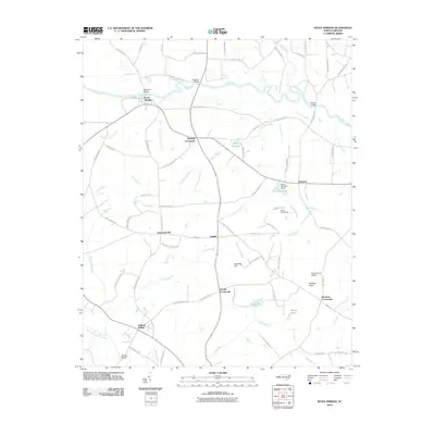
2010 Map of Seven Springs
USGS Topo · Published 2010About this map
Seven Springs anchors the northern reaches of this landscape, situated along the winding course of the Neuse River. The area is defined by a dense network of blackwater creeks and branches that drain into two major river systems, including the Northeast Cape Fear River in the south. Local agriculture and industry are historically tied to these waterways, evidenced by features such as Hardy Millpond and the Davis Millpond Dam.
Find a feature on this map
88 named features on this map. Tap any name to fly to it.
Don’t see what you’re looking for? This feature index may not catch every label — zoom into the map to look around manually.
Map Details
Editions of this 2010 Seven Springs Map
This is the sole edition of this map. No revisions or reprints were ever made.
Other maps of this area

1914 · Kinston
USGS Topo · 1:48,000

1916 · Kinston
USGS Topo · 1:62,500

1953 · Rocky Mount
USGS Topo · 1:250,000

1954 · Rocky Mount
USGS Topo · 1:250,000

1957 · Goldsboro
USGS Topo · 1:62,500

1957 · Seven Springs
USGS Topo · 1:62,500

1958 · Deep Run
USGS Topo · 1:62,500

1980 · Seven Springs
USGS Topo · 1:24,000
1980 · Summerlins Crossroads
USGS Topo · 1:24,000
1980 · Pink Hill
USGS Topo · 1:24,000