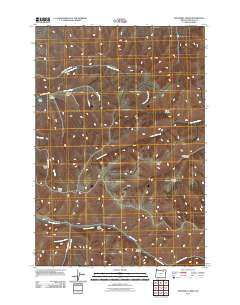
2011 Map of Sevenmile Creek
USGS Topo · Published 2011About this map
Sevenmile Creek and Little Sevenmile Creek wind through this corner of Umatilla County, defining a landscape of deep drainages and high plateaus. The drainage pattern is heavily etched by numerous seasonal and perennial watercourses, including Little McKay Creek in the north and the meandering East Birch Creek across the southern edge. This 2011 survey reveals a territory primarily shaped by its topographical features and a sparse network of rural roads that follow the natural contours of the land. Local landmarks like Porter Hill and the broad Rankin Flats stand as distinct geographic markers above the canyon floors. Human activity is evidenced by roads such as Little McKay Creek Rd and Pearson Creek Rd, which provide access to family-named landmarks like Gibson Gulch and Turrell Canyon. The map provides clear detail for those studying the physical geography or land ownership patterns of this rural Oregon interior.
Find a feature on this map
24 named features on this map. Tap any name to fly to it.
Don’t see what you’re looking for? This feature index may not catch every label — zoom into the map to look around manually.
Map Details
Editions of this 2011 Sevenmile Creek Map
This is the sole edition of this map. No revisions or reprints were ever made.
Other maps of this area

1935 · Pendleton
USGS Topo · 1:125,000

1953 · Pendleton
USGS Topo · 1:250,000

1956 · Pendleton
USGS Topo · 1:250,000

1966 · Cabbage Hill
USGS Topo · 1:24,000

1966 · Mc Kay Reservoir
USGS Topo · 1:24,000

1966 · Table Rock
USGS Topo · 1:24,000
1967 · Bassey Creek
USGS Topo · 1:24,000

1967 · Granite Meadows
USGS Topo · 1:24,000

1967 · Bally Mountain
USGS Topo · 1:24,000

1967 · Pilot Rock
USGS Topo · 1:24,000