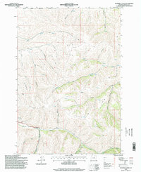
1996 Map of Sevenmile Creek
USGS Topo · Published 1998About this map
The Umatilla Indian Reservation Boundary defines the northern reaches of this landscape, where the high-elevation terrain of the Blue Mountains transitions into complex drainage systems. A network of unimproved roads and 4WD tracks navigates a series of steep canyons, including McDonald Canyon and Axle Canyon, which channel seasonal water into the broader basins below. This 1996 survey reflects a working landscape characterized by resource management and land allotment, evident in the presence of a Gravel Pit and the systematic naming of features like Rankin Flats and Porter Hill. The hydrologic pattern is dominated by Sevenmile Creek and Little McKay Creek, supported by scattered water sources such as Sevenmile Spring and Spring points. The topographic relief of Rocky Ridge provides a natural divide for the watersheds of East Birch Creek and Pearson Creek in the south.
Find a feature on this map
24 named features on this map. Tap any name to fly to it.
Don’t see what you’re looking for? This feature index may not catch every label — zoom into the map to look around manually.
Map Details
Editions of this 1996 Sevenmile Creek Map
This is the sole edition of this map. No revisions or reprints were ever made.
Other maps of this area

1935 · Pendleton
USGS Topo · 1:125,000

1953 · Pendleton
USGS Topo · 1:250,000

1956 · Pendleton
USGS Topo · 1:250,000

1966 · Cabbage Hill
USGS Topo · 1:24,000

1966 · Mc Kay Reservoir
USGS Topo · 1:24,000

1966 · Table Rock
USGS Topo · 1:24,000
1967 · Bassey Creek
USGS Topo · 1:24,000

1967 · Granite Meadows
USGS Topo · 1:24,000

1967 · Bally Mountain
USGS Topo · 1:24,000

1967 · Pilot Rock
USGS Topo · 1:24,000