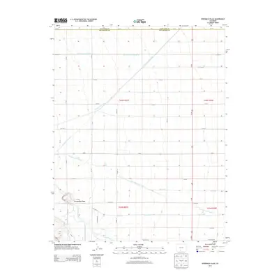
2013 Map of Sevenmile Plaza
USGS Topo · Published 2013About this map
Sevenmile Plaza serves as the focal point of this agricultural region in the San Luis Valley, where a sophisticated network of water management defines the landscape. The Rio Grande flows through the southern portion of the quadrangle, feeding an extensive system of irrigation infrastructure that has sustained local farming for generations. Dominant water features like the Farmers Union Canal, Monte Vista Canal, and Prairie Ditch carve through the terrain, illustrating the critical role of water rights and engineering in this high-altitude valley. The grid-like road system, including Maxeyville Rd and Ditch Riders Rd, provides access to these vital waterways and the fields they serve. Spanning the border of Saguache and Rio Grande counties, the area reflects a deeply rooted rural economy organized around the precise movement of water from the river to the surrounding plains.
Find a feature on this map
37 named features on this map. Tap any name to fly to it.
Don’t see what you’re looking for? This feature index may not catch every label — zoom into the map to look around manually.
Map Details
Editions of this 2013 Sevenmile Plaza Map
This is the sole edition of this map. No revisions or reprints were ever made.
Other maps of this area

1915 · Del Norte
USGS Topo · 1:125,000

1917 · Del Norte
USGS Topo · 1:125,000

1945 · Durango
USGS Topo · 1:250,000

1953 · Durango
USGS Topo · 1:250,000

1954 · Durango
USGS Topo · 1:250,000

1961 · Durango
USGS Topo · 1:250,000

1963 · Durango
USGS Topo · 1:250,000

1964 · Sevenmile Plaza
USGS Topo · 1:24,000

1964 · Monte Vista
USGS Topo · 1:24,000

1966 · Durango
USGS Topo · 1:250,000