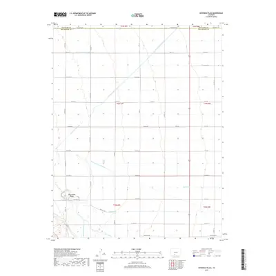
2019 Map of Sevenmile Plaza
USGS Topo · Published 2019About this map
Sevenmile Plaza serves as the focal point for this high-desert agricultural landscape, situated just north of the Rio Grande. The area is defined by an intricate network of water management features essential to the San Luis Valley, including the Farmers Union Canal, Monte Vista Canal, and Rio Grande Lateral Number 5A. These waterways intersect a rigid grid of rural roads, such as Twelvemile Rd and Maxeyville Rd, illustrating the systematic division of land for cultivation. The geography reveals a transition from the river's natural course to the engineered precision of the Prairie Ditch and Raney Ditch, which support the outlying sections of Rio Grande County and Saguache County. Local landmarks like Stoerber Ln and Ditch Riders Rd reflect the regional focus on irrigation maintenance and family-held land plots.
Find a feature on this map
45 named features on this map. Tap any name to fly to it.
Don’t see what you’re looking for? This feature index may not catch every label — zoom into the map to look around manually.
Map Details
Editions of this 2019 Sevenmile Plaza Map
This is the sole edition of this map. No revisions or reprints were ever made.
Other maps of this area

1915 · Del Norte
USGS Topo · 1:125,000

1917 · Del Norte
USGS Topo · 1:125,000

1945 · Durango
USGS Topo · 1:250,000

1953 · Durango
USGS Topo · 1:250,000

1954 · Durango
USGS Topo · 1:250,000

1961 · Durango
USGS Topo · 1:250,000

1963 · Durango
USGS Topo · 1:250,000

1964 · Sevenmile Plaza
USGS Topo · 1:24,000

1964 · Monte Vista
USGS Topo · 1:24,000

1966 · Durango
USGS Topo · 1:250,000