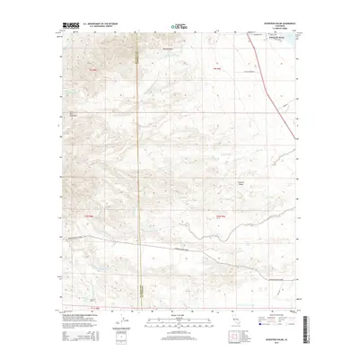
2015 Map of Seventeen Palms
USGS Topo · Published 2015About this map
Seventeen Palms and its associated Seventeen Palms Spring anchor the southwestern corner of this desert landscape, where the arid floor of the Imperial Valley meets the rising slopes of the Santa Rosa Mountains. The terrain is defined by a complex network of ephemeral watercourses including Wonderstone Wash, Coral Wash, and Palm Wash, which drain toward the northeast. In the upper reaches of the map, the settlement of Salton Sea Beach sits at the edge of the Salton Sea, while the Borrego Salton Seaway provides a primary east-west corridor through the scrubland. Evidence of historical water management and exploration is visible through features like the Anza Ditch and Four Palms Spring, illustrating the vital importance of water sources in this dry environment near the San Diego and Imperial County border.
Find a feature on this map
35 named features on this map. Tap any name to fly to it.
Don’t see what you’re looking for? This feature index may not catch every label — zoom into the map to look around manually.
Map Details
Editions of this 2015 Seventeen Palms Map
This is the sole edition of this map. No revisions or reprints were ever made.
Other maps of this area

1904 · Indio
USGS Topo · 1:125,000

1931 · Vallecito
USGS Topo · 1:125,000

1940 · Kane Spring
USGS Topo · 1:62,500

1940 · Durmid
USGS Topo · 1:62,500

1942 · Barrel Spring
USGS Topo · 1:62,500

1942 · Agua Dulce
USGS Topo · 1:62,500

1943 · Vallecito
USGS Topo · 1:125,000

1944 · Agua Dulce
USGS Topo · 1:62,500

1944 · Durmid
USGS Topo · 1:62,500

1944 · Kane Spring
USGS Topo · 1:62,500