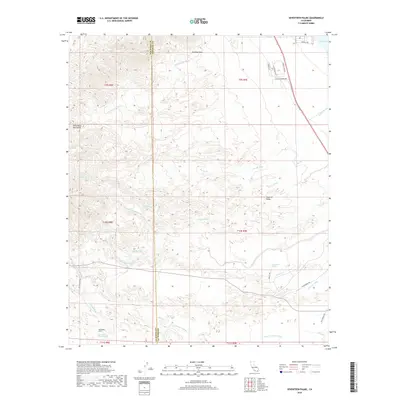
2018 Map of Seventeen Palms
USGS Topo · Published 2018About this map
Seventeen Palms and its associated Seventeen Palms Spring serve as the focal point for this desert landscape where the San Diego County and Imperial County line intersects the arid reaches of the Imperial Valley. The terrain is defined by a complex network of drainage systems, including the Wonderstone Wash, Palm Wash, and Arroyo Salada, which channel runoff from the Santa Rosa Mountains toward the Salton Sea in the northeast. This 2018 survey documents a remote environment shaped by both geological features like Rainbow Rock and human infrastructure such as the Anza Ditch. Desert travelers and researchers can trace the path of the Truckhaven Trl as it crosses the washes, alongside various named springs like Four Palms Spring that have historically sustained life in this water-scarce region.
Find a feature on this map
34 named features on this map. Tap any name to fly to it.
Don’t see what you’re looking for? This feature index may not catch every label — zoom into the map to look around manually.
Map Details
Editions of this 2018 Seventeen Palms Map
This is the sole edition of this map. No revisions or reprints were ever made.
Other maps of this area

1904 · Indio
USGS Topo · 1:125,000

1931 · Vallecito
USGS Topo · 1:125,000

1940 · Kane Spring
USGS Topo · 1:62,500

1940 · Durmid
USGS Topo · 1:62,500

1942 · Barrel Spring
USGS Topo · 1:62,500

1942 · Agua Dulce
USGS Topo · 1:62,500

1943 · Vallecito
USGS Topo · 1:125,000

1944 · Agua Dulce
USGS Topo · 1:62,500

1944 · Durmid
USGS Topo · 1:62,500

1944 · Kane Spring
USGS Topo · 1:62,500