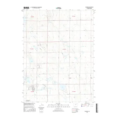
2016 Map of Severance
USGS Topo · Published 2016About this map
The town of Severance serves as the focal point for this 2016 survey of Weld County, displaying a landscape defined by an intricate network of irrigation and water storage. A series of reservoirs and lakes, including Black Hollow Reservoir, Loup Lake, and Wykert Reservoir Number 1, dominate the terrain, reflecting the region's agricultural dependency on water management. The infrastructure of the high plains is evident in the man-made watercourses like the Eaton Ditch, Pierce Lateral, and Lakeside Lateral, which crisscross the landscape to support local farming. Smaller rural settlements such as Hurrich and Gates appear alongside newer residential developments indicated by street names like Timber Ridge Pkwy and Scotch Pine Dr. This documentation provides a clear look at the intersection of traditional water engineering and modern suburban expansion in northern Colorado.
Find a feature on this map
74 named features on this map. Tap any name to fly to it.
Don’t see what you’re looking for? This feature index may not catch every label — zoom into the map to look around manually.
Map Details
Editions of this 2016 Severance Map
This is the sole edition of this map. No revisions or reprints were ever made.
Other maps of this area

1902 · Greeley
USGS Topo · 1:125,000

1908 · Eaton
USGS Topo · 1:125,000

1910 · Eaton
USGS Topo · 1:125,000

1950 · Greeley
USGS Topo · 1:24,000

1950 · Windsor
USGS Topo · 1:24,000

1950 · Bracewell
USGS Topo · 1:24,000
1951 · Bracewell
USGS Topo · 1:24,000

1954 · Greeley
USGS Topo · 1:250,000

1957 · Greeley
USGS Topo · 1:250,000

1958 · Greeley
USGS Topo · 1:250,000