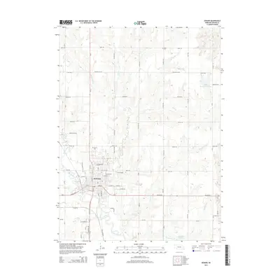
2014 Map of Seward
USGS Topo · Published 2014About this map
Seward serves as the focal point of this 2014 survey, situated at the confluence of the Big Blue River and Lincoln Cr. The town's academic and civic character is defined by the campus of Concordia Univ and several established burial grounds, including Greenwood Cem and Seward Cem. This landscape in eastern Nebraska is heavily marked by a grid of rural roads and numerous waterways that drain the agricultural plains, such as Plum Cr, Coon Cr, and Shadley Vale Cr.
Find a feature on this map
43 named features on this map. Tap any name to fly to it.
Don’t see what you’re looking for? This feature index may not catch every label — zoom into the map to look around manually.
Map Details
Editions of this 2014 Seward Map
This is the sole edition of this map. No revisions or reprints were ever made.
Other maps of this area

1897 · Lincoln
USGS Topo · 1:125,000

1899 · Wahoo
USGS Topo · 1:125,000

1899 · David City
USGS Topo · 1:125,000

1934 · Seward
USGS Topo · 1:48,000

1939 · Seward
USGS Topo · 1:62,500

1955 · Fremont
USGS Topo · 1:250,000

1955 · Lincoln
USGS Topo · 1:250,000

1957 · Fremont
USGS Topo · 1:250,000

1957 · Lincoln
USGS Topo · 1:250,000

1958 · Fremont
USGS Topo · 1:250,000