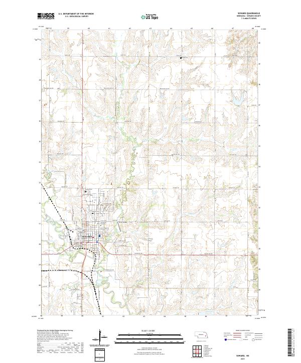
2021 Map of Seward
USGS Topo · Published 2021About this map
Seward serves as a prominent regional hub at the confluence of the Big Blue River and Lincoln Cr, where the landscape transitions from the dense street grid of the city to the expansive agricultural sections of eastern Nebraska. The map details the administrative and educational heart of the county, featuring the Seward County Courthouse and the campus of Concordia University Nebraska. Beyond the town limits, the terrain is defined by a network of drainage ways including Plum Cr and Coon Cr, with small local airstrips like Krutz Airport and quiet burial grounds such as Union Cem and Greenwood Cem scattered across the township lines of T11N and T12N. This survey documents the modern layout of the area's rural roads and section boundaries, illustrating how the regional watercourses continue to influence the placement of infrastructure and residential development.
Find a feature on this map
66 named features on this map. Tap any name to fly to it.
Don’t see what you’re looking for? This feature index may not catch every label — zoom into the map to look around manually.
Map Details
Editions of this 2021 Seward Map
This is the sole edition of this map. No revisions or reprints were ever made.
Other maps of this area

1897 · Lincoln
USGS Topo · 1:125,000

1899 · Wahoo
USGS Topo · 1:125,000

1899 · David City
USGS Topo · 1:125,000

1934 · Seward
USGS Topo · 1:48,000

1939 · Seward
USGS Topo · 1:62,500

1955 · Fremont
USGS Topo · 1:250,000

1955 · Lincoln
USGS Topo · 1:250,000

1957 · Fremont
USGS Topo · 1:250,000

1957 · Lincoln
USGS Topo · 1:250,000

1958 · Fremont
USGS Topo · 1:250,000