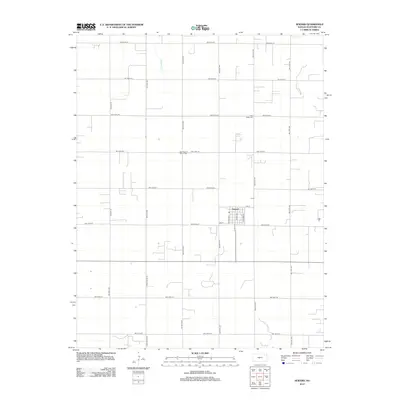
2012 Map of Seward
USGS Topo · Published 2012About this map
Seward stands as a central point of activity within the rural grid of Stafford County, where residential streets like Lincoln Ave and Stafford St converge. This portion of the Kansas landscape is defined by its rectilinear road network, punctuated by small community landmarks that offer a window into local genealogy and settlement history. To the north, Antelope Cr meanders across the agricultural sections, providing a natural break in the structured township lines. Family history researchers will find significance in the presence of the Eden Valley Cem and Saint Francis Xavier Cem, both of which serve as enduring anchors for the surrounding community. The map traces the steady development of this prairie region, from the clustered homes in town to the reaches of Eden Valley Rd and the series of numbered northwestern roads.
Find a feature on this map
25 named features on this map. Tap any name to fly to it.
Don’t see what you’re looking for? This feature index may not catch every label — zoom into the map to look around manually.
Map Details
Editions of this 2012 Seward Map
This is the sole edition of this map. No revisions or reprints were ever made.
Other maps of this area

1891 · Great Bend
USGS Topo · 1:125,000

1893 · Great Bend
USGS Topo · 1:125,000

1955 · Great Bend
USGS Topo · 1:250,000

1957 · Great Bend
USGS Topo · 1:250,000

1957 · Ellinwood SW
USGS Topo · 1:24,000

1958 · Great Bend
USGS Topo · 1:250,000

1958 · Great Bend
USGS Topo · 1:24,000

1960 · Pawnee Rock
USGS Topo · 1:24,000
1969 · Radium
USGS Topo · 1:24,000
1970 · Hudson NW
USGS Topo · 1:24,000