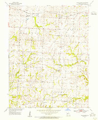
1953 Map of Shackleford
USGS Topo · Published 1955About this map
Shackleford sits at the northern end of this mid-century survey, a rail stop along the Gulf Mobile and Ohio line where it crosses Straddle Creek. The landscape of central Saline County is defined by a dense network of rural infrastructure, particularly its numerous country schools such as Sunny Side Sch and South Grove Sch, which were central to these farming townships before mid-century consolidation.
Find a feature on this map
26 named features on this map. Tap any name to fly to it.
Don’t see what you’re looking for? This feature index may not catch every label — zoom into the map to look around manually.
Map Details
Editions of this 1953 Shackleford Map
2 editions found
Other maps of this area

1887 · Sedalia
USGS Topo · 1:125,000

1890 · Marshall
USGS Topo · 1:125,000

1892 · Marshall
USGS Topo · 1:125,000

1894 · Sedalia
USGS Topo · 1:125,000

1901 · Marshall
USGS Topo · 1:125,000

1939 · Sweet Springs
USGS Topo · 1:62,500

1940 · Sweet Springs
USGS Topo · 1:62,500

1940 · Marshall
USGS Topo · 1:62,500

1941 · Sweet Springs
USGS Topo · 1:62,500

1944 · Marshall
USGS Topo · 1:62,500