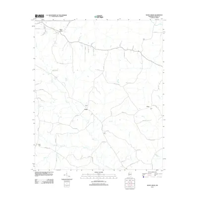
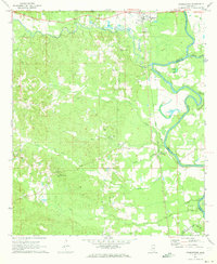
2012 Map of Shady Grove
USGS Topo · Published 2012About this map
The community of Shady Grove anchors the northwest corner of this Copiah County landscape, where rural life is defined by a dense network of creeks and small family cemeteries. Streams like Bahala Cr and Lick Cr carve through the terrain, dictating the placement of settlements such as Sardis and Ashley. For genealogists, the map is particularly revealing, as it preserves the locations of numerous burial grounds including Bethel Cem, Mullens Cem, and the Russell-Tillman Cem. These sites, often situated near the headwaters of branches like Sardis Br or Anding Br, mark the deep ancestral roots of the local population. The road system, including Martinsville Rd and Monticello Rd, reflects a history of movement between these quiet rural centers in south-central Mississippi.
Find a feature on this map
61 named features on this map. Tap any name to fly to it.
Don’t see what you’re looking for? This feature index may not catch every label — zoom into the map to look around manually.
Map Details
Editions of this 2012 Shady Grove Map
This is the sole edition of this map. No revisions or reprints were ever made.
Other maps of this area

1953 · Natchez
USGS Topo · 1:250,000

1956 · Natchez
USGS Topo · 1:250,000

1959 · Natchez
USGS Topo · 1:250,000
1963 · Crystal Springs
USGS Topo · 1:24,000
1963 · Gallman
USGS Topo · 1:24,000

1963 · Hazlehurst
USGS Topo · 1:24,000

1963 · Shady Grove
USGS Topo · 1:24,000
1970 · Hopewell
USGS Topo · 1:24,000

1971 · Oma
USGS Topo · 1:24,000
1971 · Georgetown
USGS Topo · 1:24,000